Good morning — hope you’re having a good morning. It’s Friday, November 13th — World Kindness Day, and yes, Friday the 13th too. A good morning to be kind to someone, and to stay dry while you’re at it.
“The best thing one can do when it’s raining is to let it rain.” — Henry Wadsworth Longfellow
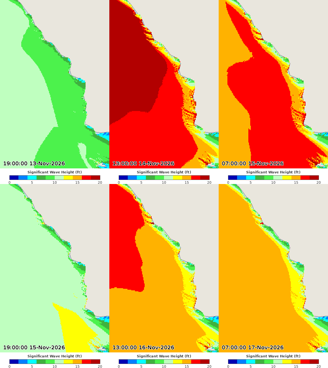
Two words for this morning: rain, and waves — big ones. The rain is on and off into next week, and the surf is running 18 to 25 feet on west-facing beaches. Here’s the full picture.
How this page works: the further down you go, the deeper it gets. The big picture first, then your local forecast, the radar, the rain and wave forecasts — and further down, the extended outlooks, El Niño, and the rainfall picture.

The big picture
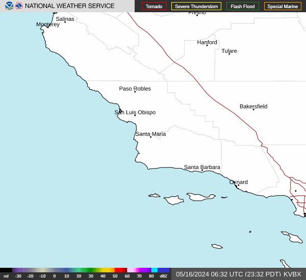
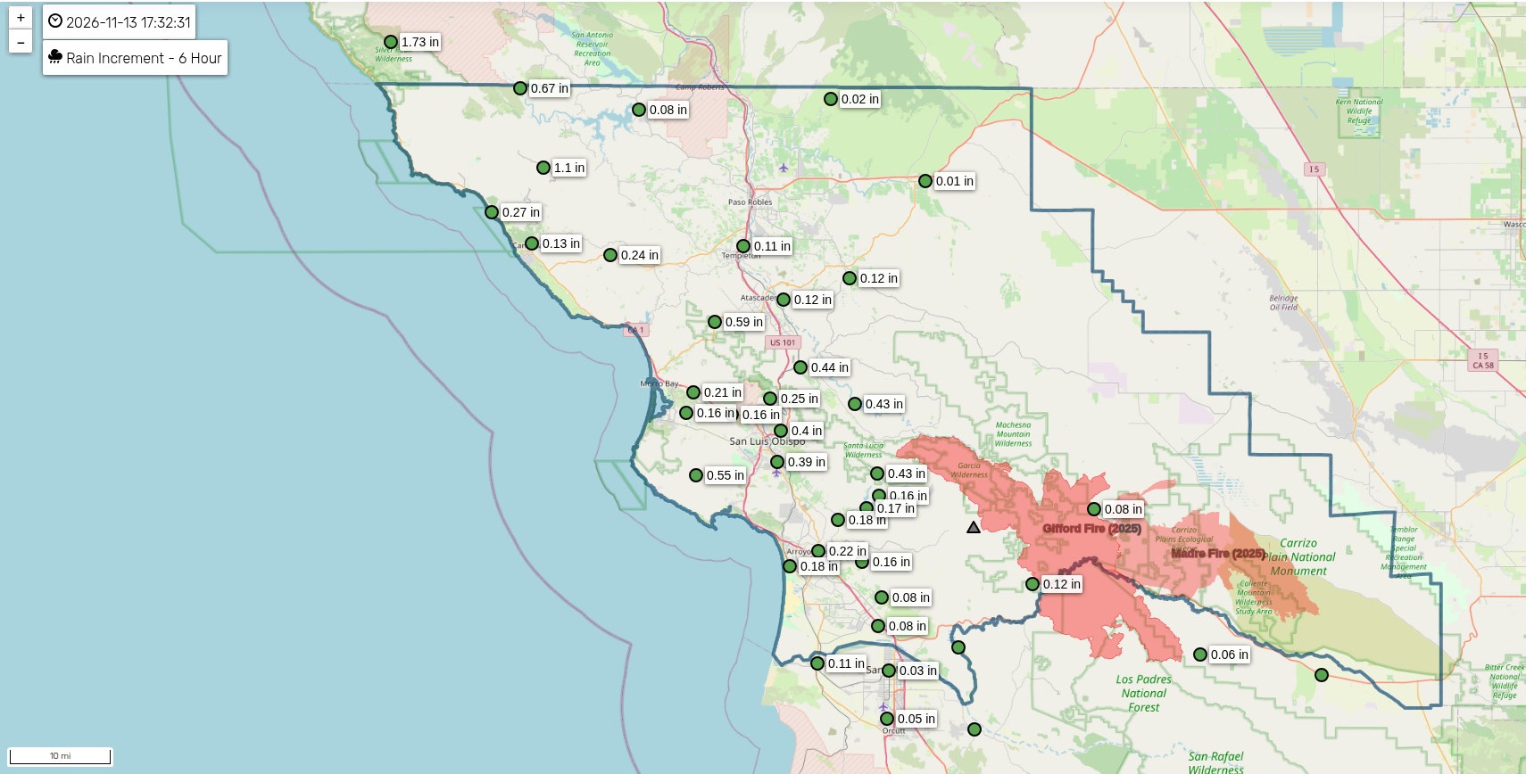
We are in a classic November pattern — a parade of Pacific systems, each bringing a pulse of rain, separated by brief dry breaks. The first impulse, an upper low tracking over the water toward northern Baja, is already producing scattered showers this morning. Rainfall rates have generally stayed under a quarter-inch per hour, though a few spots have seen half an inch per hour. The showers are moving quickly, which limits the flooding risk, and there is still a slight chance of a thunderstorm this morning.
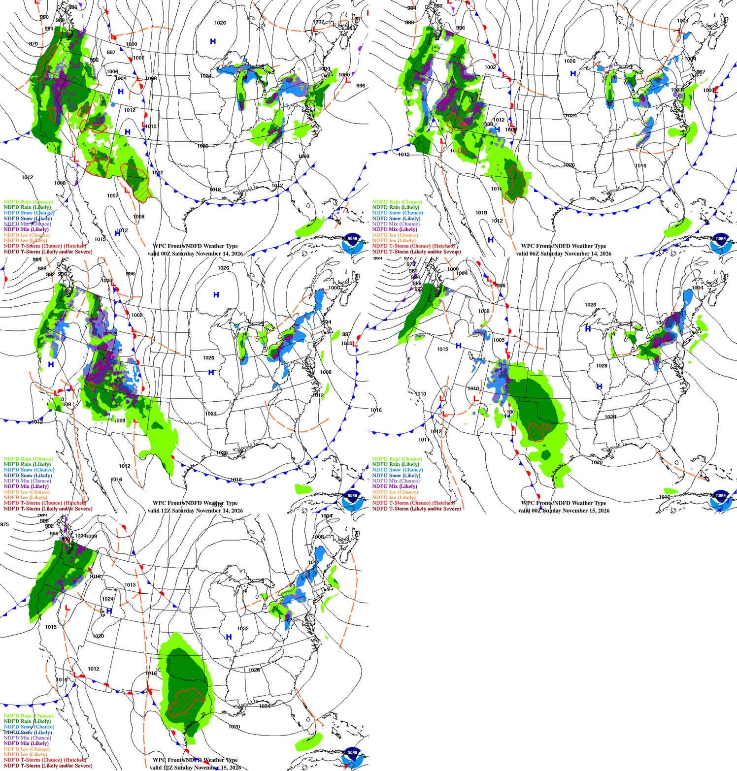
The main event arrives this morning. A more classic cold front pushes into San Luis Obispo County this morning and sweeps southeast across the area through Saturday morning, bringing a 3- to 5-hour period of light to moderate rain. Rain rates should stay around a quarter-inch per hour or less. All told, expect 0.25 to 0.75 inches through Saturday morning, with isolated spots near an inch where a heavier shower or thunderstorm sets up.
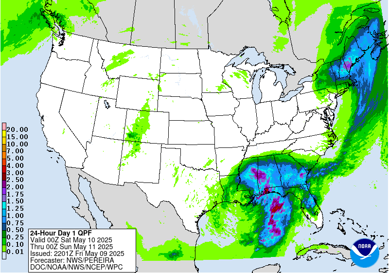
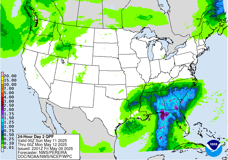
After the front clears Saturday afternoon, we get a dry break — Saturday afternoon through Sunday evening looks dry. But do not put the umbrella away: another system arrives Sunday night, and the wet, unsettled pattern continues into next week, with rain likely Monday and again Wednesday into Thursday. The Monday system looks lighter, around a quarter-inch or less, while the midweek system could bring 0.25 to 1.00 inches.
Rainfall outlook
SLO County Rainfall
Frontal animation
Coastal valleys
- Rain this morning, 0.25 to 0.75 inches through Saturday morning; highs mid-60s to around 70; south winds 15 to 25 mph shifting northwest this morning.
- Saturday turns sunny after a partly cloudy morning; dry through Sunday evening.
- Rain returns Monday, then again Wednesday into Thursday; highs upper 50s to mid-60s, lows in the 40s.
Beaches
- Rain this morning, high near 67; breezy southwest winds gusting to 25; another tenth to a quarter-inch.
- Saturday is sunny and dry, high near 67 — but surf is the story: 18 to 25 feet, with a High Surf Warning 9 p.m. Friday to 3 a.m. Sunday and a Coastal Flood Warning 3 a.m. to 6 p.m. Saturday. Expect beach erosion, flooding of low-lying walkways and parking lots near high tide, dangerous rip currents, and breaking waves at the Morro Bay Harbor entrance and the Pismo and Cayucos piers.
- Rain returns Sunday night and Monday, then again Wednesday.
Interior valleys
- Rain this morning; highs lower to mid-60s, lows mid-40s to around 50.
- Saturday is sunny, highs mid- to upper 60s; dry through Sunday.
- Rain Monday and again Wednesday into Thursday; Monday night lows dip into the mid- to upper 30s, Tuesday night into the mid-30s to around 40 — the coldest nights of the stretch.
Santa Barbara Southcoast
- Rain this morning, high near 73; a tenth to a quarter-inch.
- Saturday is sunny and warm, high near 74; dry through Sunday.
- Rain Monday, mainly before 4 p.m., high near 67; a chance of rain lingers Wednesday and Thursday, highs near 67.
Marine — Central Coast
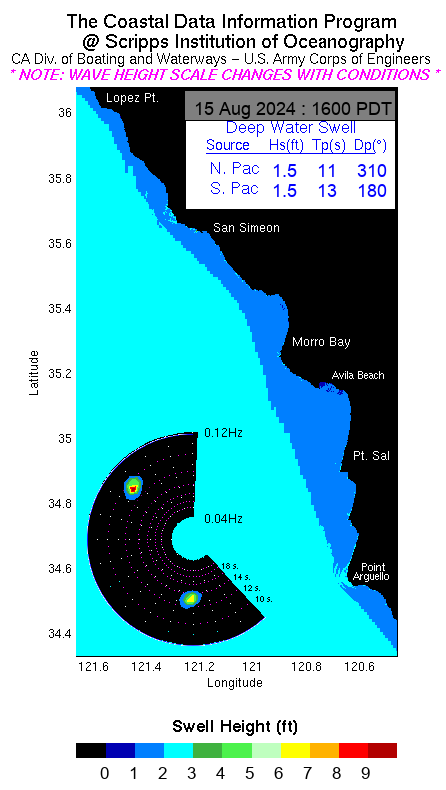
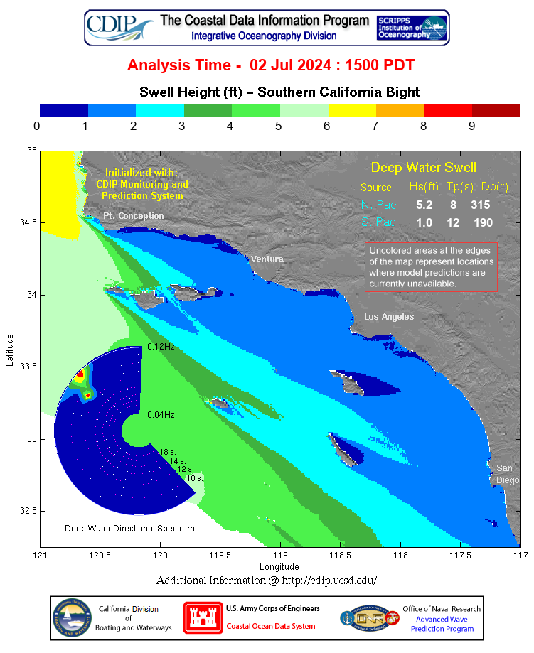
A Small Craft Advisory runs through late Tuesday night. West-southwest winds around 20 knots gusting to 25 this morning, with rain and a west swell of 8 feet at 14 seconds. Seas build fast: dangerously large seas peak Saturday at 18 to 22 feet in the outer waters and 14 to 20 feet in the inner waters north of Point Sal, with a secondary peak Monday. Dangerous breaking waves are expected at the Morro Bay harbor entrance.
Marine — Southcoast
Southwest winds around 10 knots this morning, showers through the morning, wind waves 1 foot or less. Saturday is sunny with northwest winds 5 to 10 knots. A Small Craft Advisory is likely Saturday across the western Santa Barbara Channel. Monday and Tuesday bring a 60 to 80 percent chance of Small Craft Advisory-level winds and a 30 to 40 percent chance of gale-force winds south of Point Conception.
Tools

El Niño Status
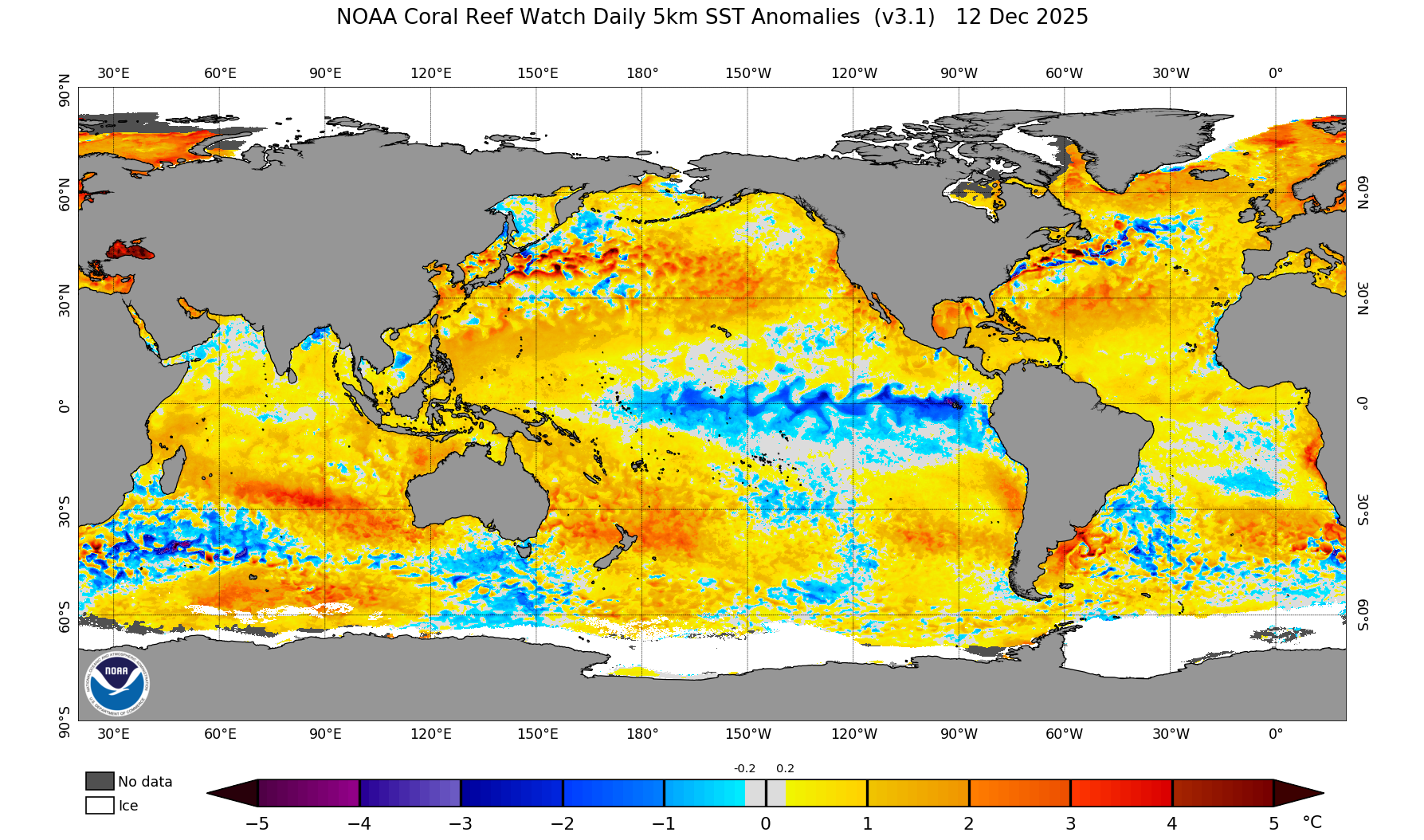
El Niño is strengthening, and it is now a big one. Sea surface temperatures in the eastern equatorial Pacific are running more than 4 degrees Celsius above average, with the key Niño-3.4 region at +2.5°C, Niño-3 at +3.6°C, and the far eastern Pacific at a remarkable +4.4°C. The warm water runs deep, too — subsurface temperatures are more than 10 degrees above average at depth — a deep reservoir that will keep feeding this event.
The Climate Prediction Center says a strong-to-very strong El Niño is likely through January–March 2027, at better than a 79 percent chance, and there is now about a 60 percent chance this becomes a historic El Niño, exceeding any since 1950. It is expected to keep strengthening before it begins to weaken in early 2027.
What it means for us: a strong El Niño tilts the odds toward a wetter-than-average winter across California, with more storms tracking into the state. It is not a guarantee — even a very strong El Niño does not promise rain in any given week — but the chances of a wet winter are higher than normal. The next official update comes December 10.
Long-range outlooks