
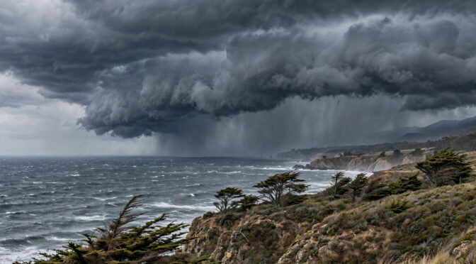
Good evening — hope the day treated you well. It’s Wednesday, November 18th — Mickey Mouse Day (Steamboat Willie premiered on this date in 1928), National Princess Day, and National Apple Cider Day. A good night for a warm cider — and a good night to stay in, if you can.
Words for this evening: storm day. An atmospheric river is aimed at the Central Coast — dry and chilly to start today, then rain, wind, and big surf building this evening and tonight, with the heaviest weather Wednesday night into Thursday. Here’s the full picture, and what you’ll wake up to.
Latest radar — click to animate
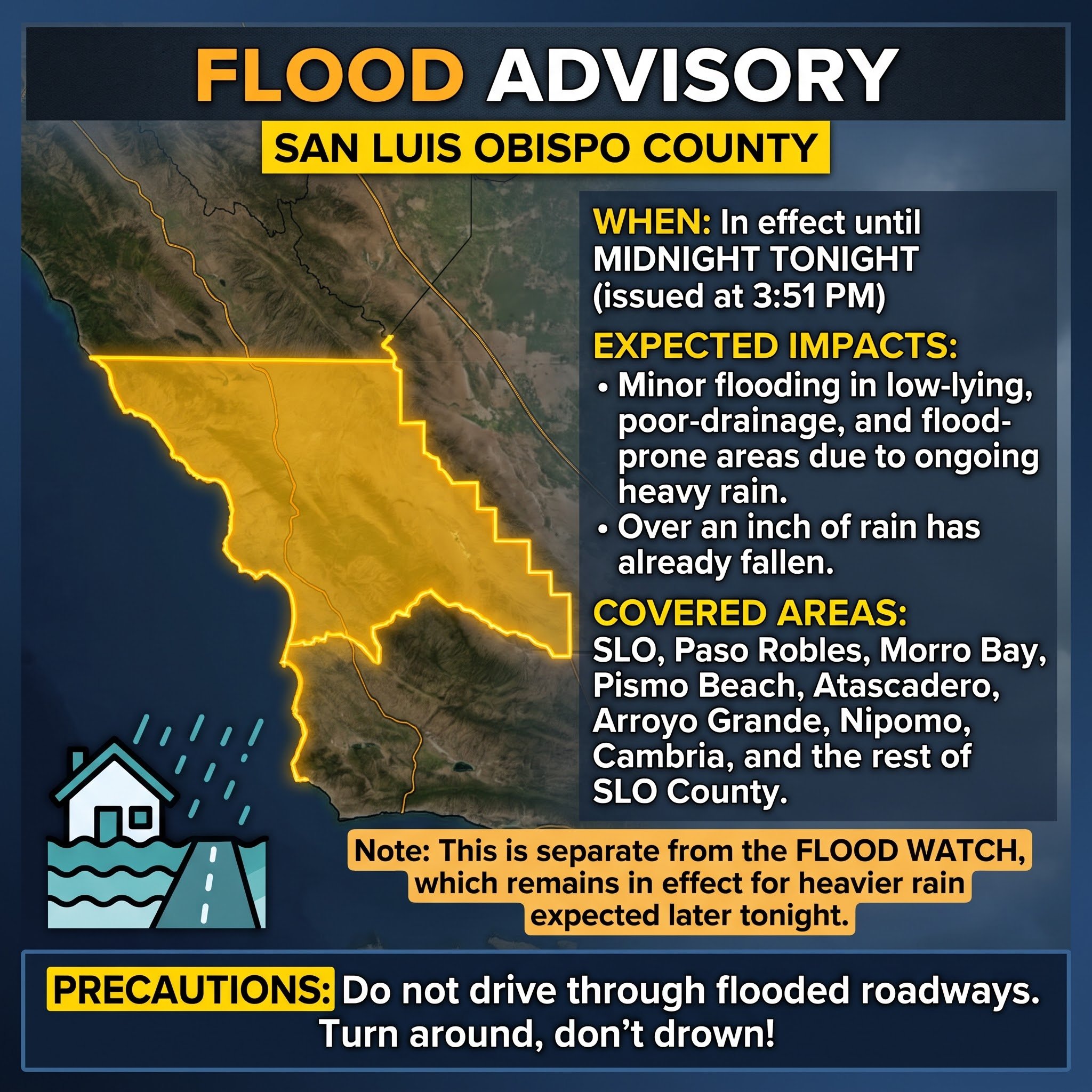
⚠️ Update this afternoon: a Flood Advisory is now in effect for San Luis Obispo County until midnight tonight. Minor flooding is expected in low-lying and poor-drainage areas from the ongoing heavy rain — over an inch has already fallen. This is separate from the Flood Watch, which remains in effect for the heavier rain expected later tonight. Do not drive through flooded roadways.
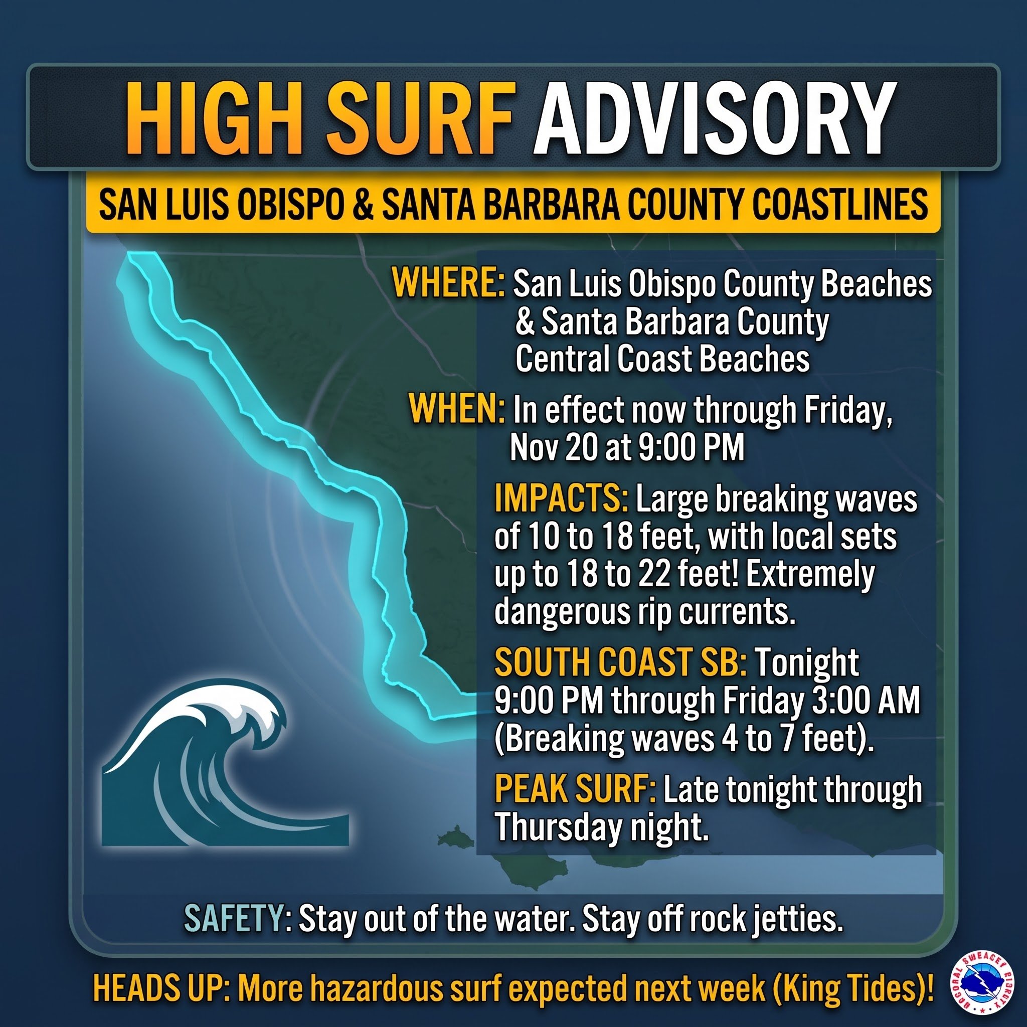
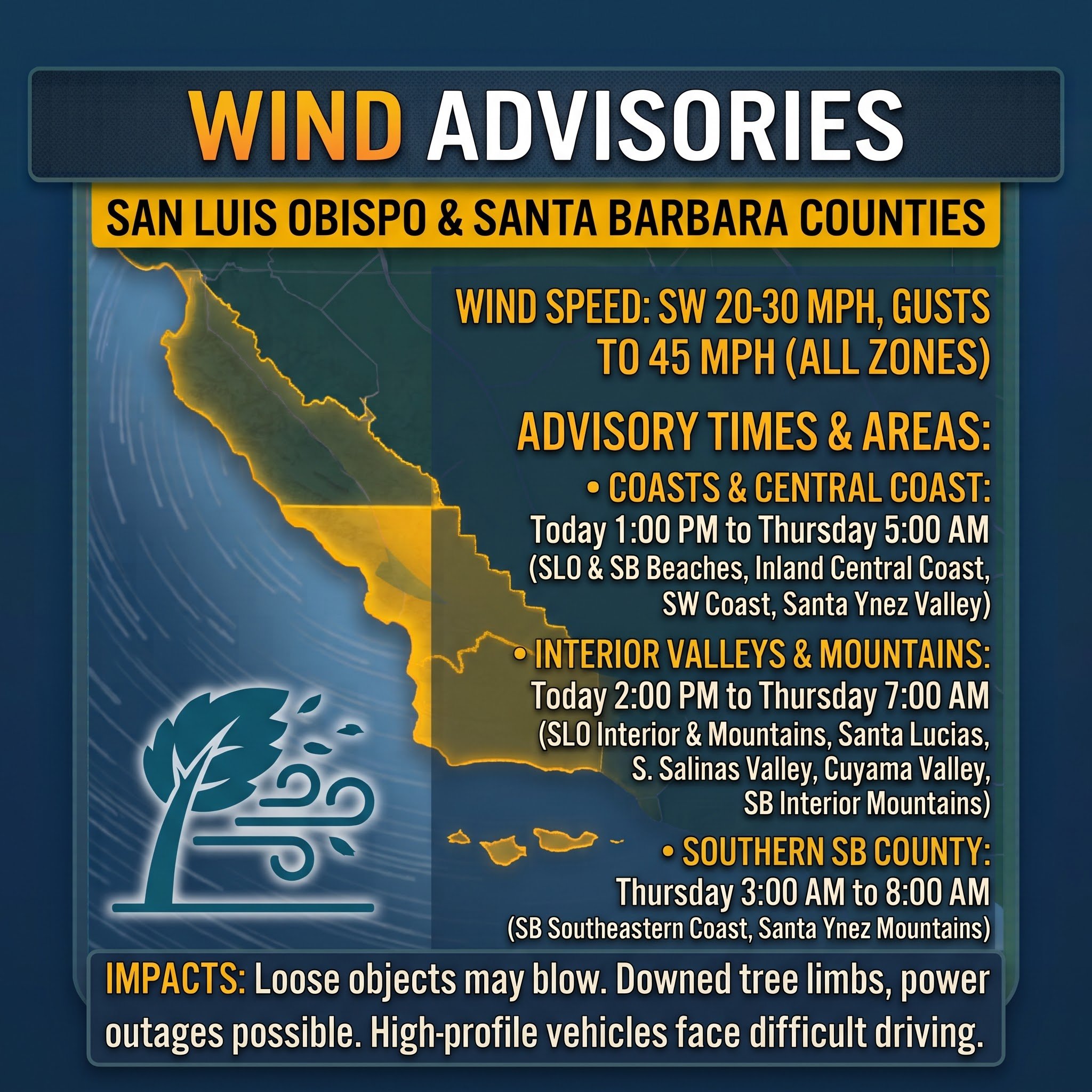
⚠️ A Flood Watch is in effect for San Luis Obispo County from 3 PM this afternoon through 6 AM Thursday, and for Santa Barbara County from 8 PM tonight through 1 PM Thursday. Flooding caused by excessive rainfall is possible — rain rates up to 1 inch per hour in the mountains and up to 0.75 inches per hour elsewhere. A High Surf Advisory is also in effect, with large breaking waves of 10 to 19 feet and local sets of 20 to 22 feet. Avoid flooded roads and low-lying areas, and stay off coastal rocks and jetties.
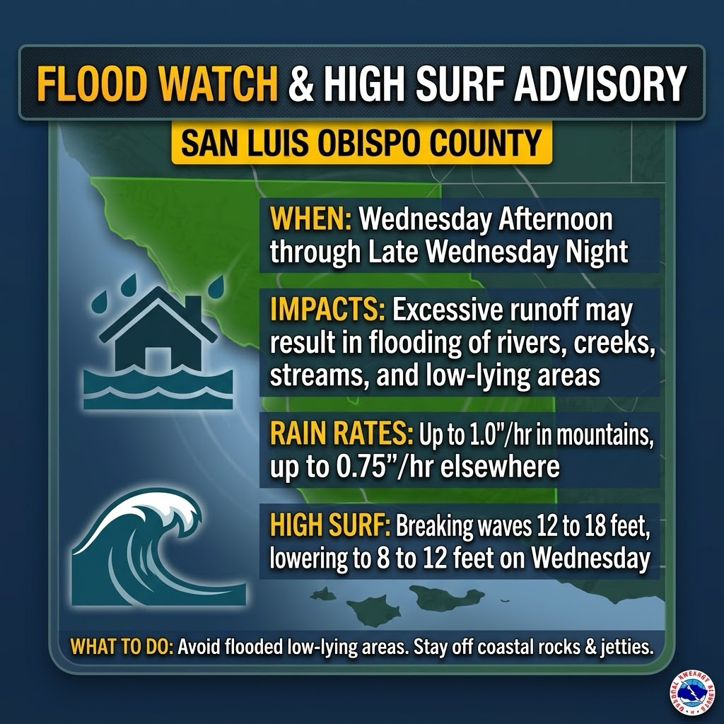
Flood Watch and High Surf Advisory for San Luis Obispo County — Wednesday afternoon through late Wednesday night.
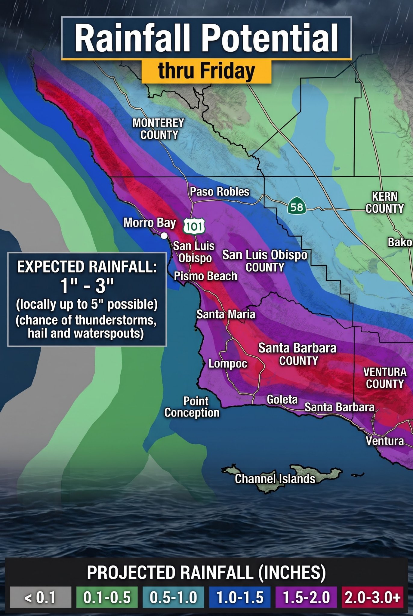
Rainfall potential through Friday — generally 1 to 3 inches across the Central Coast, with locally up to 5 inches possible on the south-facing hills.
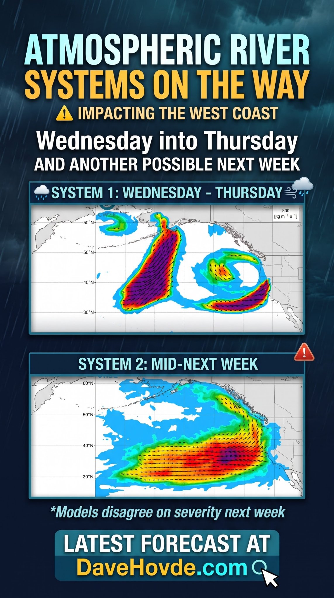
Atmospheric river systems on the way — the first arrives today into Thursday, with another possible next week. Models disagree on next week’s severity.
“Some people walk in the rain, others just get wet.” — Roger Miller

Weather Anywhere
Want the forecast for somewhere else? Type any place — the forecast, stripped down to the words that matter.
Forecasts: U.S. places from the National Weather Service; elsewhere from Open-Meteo. Full Weather Anywhere page
Get Dave's Weather as an app
Add the forecast to your home screen — one tap, and it's right there every morning.
On iPhone: tap Share, then Add to Home Screen to install Dave's Weather.
The big picture
The quiet start is over — the storm is here. This morning was dry and chilly with increasing clouds. You’ll wake up to the heaviest rain moving through, with tomorrow’s highs in the low 60s on the coast, upper 50s in the interior valleys, and mid-60s on the Southcoast — still about 4 to 8 degrees below normal. Then the first moderate-to-strong storm of the season — fed by an atmospheric river — arrives. Rain started over northwest San Luis Obispo County this afternoon and is spreading across the rest of the Central Coast this evening, reaching Santa Barbara later tonight, where the strongest rain moves through between about 2 and 5 AM Thursday.
When it comes, it comes hard. Most of the coast and valleys pick up 1 to 2 inches, locally 3 inches, with 3 to 5 inches on the coastal slopes and south-facing foothills, and under an inch in the far interior. Rain rates of a half-inch per hour are likely, with 0.75 to 1 inch per hour under thunderstorms and across the south-facing slopes — exactly the setup the Flood Watch is posted for: roadway and low-lying flooding, heavy flows in creeks and canyons, rockslides, and trouble near recent burn scars. There is about a 20 percent chance of thunderstorms with this system, and a thunderstorm could bring hail, a heavy downpour, and even a waterspout offshore. South winds of 20 to 30 mph with gusts to 45 mph are under a Wind Advisory from this afternoon into early Thursday — secure loose items, expect difficult driving for high-profile vehicles, and watch for downed limbs and a few power outages, especially with rain-loosened soil. Snow levels stay high for most of the storm, dropping to about 7,000 feet on the back end Thursday. If you can move outdoor plans and travel to Friday, do it — tonight and Thursday morning are the window to avoid.
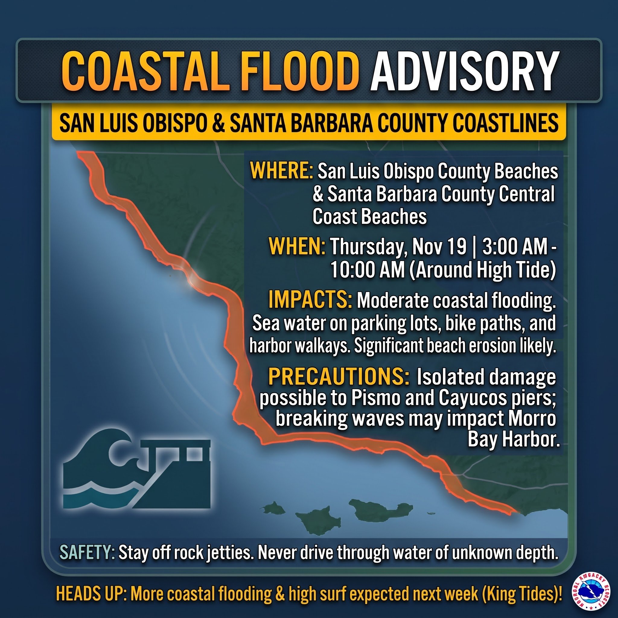
The coast is dangerous, too. Surf lowers this morning, then a much larger swell builds late tonight through Thursday: breaking waves of 10 to 19 feet with local sets of 20 to 22 feet, under a High Surf Advisory that runs through 9 PM Friday. A Coastal Flood Advisory is posted for Thursday from 3 to 10 AM, when the morning high tide meets the big swell — expect flooding of beach parking lots, bike paths, and harbor walkways, significant beach erosion, possible damage at the Pismo and Cayucos piers, and breaking waves at the Morro Bay Harbor entrance. Stay off rocks and jetties, and never turn your back on this surf.
Friday turns dry and sunny with brisk northwest winds, and Saturday stays dry under a passing ridge — still cool, 5 to 10 degrees below normal. Sunday brings the next, much weaker system: rain is likely on the Central Coast (up to about a quarter-inch), with only about a 40 percent chance it reaches south of Point Conception. Monday dries out again. And keep an eye on Thanksgiving week: the models are mixed, but the door is open to more active weather — another system is possible later Tuesday into Wednesday — and the tides alone are a story, running an extreme 8.1 to 8.6 feet or more Monday through Friday of Thanksgiving week, with additional swell possible. Stay up to date — we are monitoring it and will bring you new details as they develop.
The three graphics below lay out the coastal hazards day by day, when the rain chances peak, and the expected storm totals — and the live rainfall and reservoir maps further down will track this storm as it happens.
Here it comes — the front sweeps into Northern California this morning with a narrow cold frontal rainband, strong winds, and high rain rates. For the Central Coast the main event holds off until later today, but this storm still packs a punch when it arrives:
The system headed our way is already lighting up the coast to our north — hundreds of lightning strikes detected offshore Tuesday evening as the front approaches:
And inland, this storm train is set to hammer the Sierra Nevada — 4 to 5 feet of snow in places over the next 11 days:
📧 Get the daily forecast by email — one email each morning with the full Central Coast forecast:
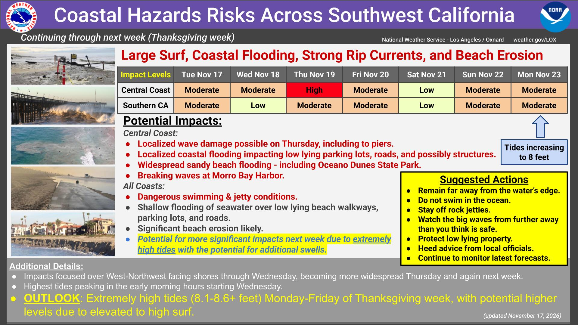
Coastal hazards risk — the Central Coast impact level is HIGH on Thursday: localized wave damage is possible, including to piers, along with localized coastal flooding of roads and structures, widespread sandy beach flooding including at Oceano Dunes State Park, and breaking waves at Morro Bay Harbor. Tides are increasing toward 8 feet — and extremely high tides of 8.1 to 8.6 feet or more are possible Monday through Friday of Thanksgiving week.
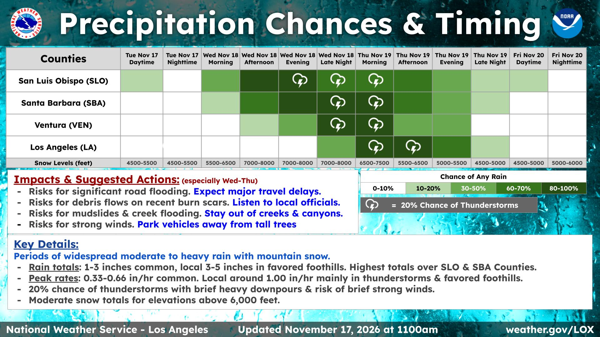
Precipitation chances & timing — the best rain chances on the Central Coast run from this evening through Thursday.
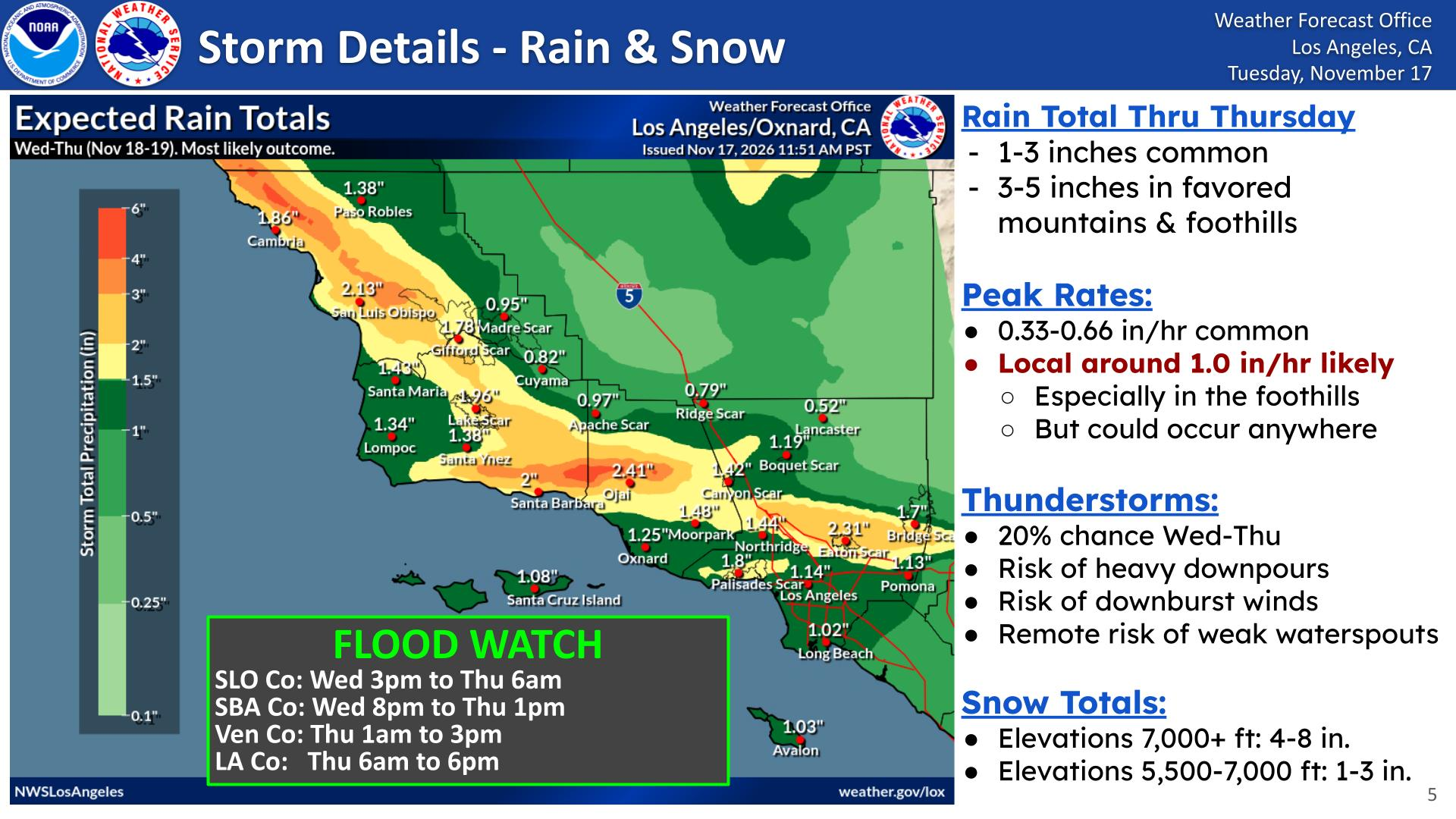
Storm details — expected rain Wednesday into Thursday: San Luis Obispo 2.13 inches, Cambria 1.86 inches, Santa Barbara 2 inches. Flood Watch: San Luis Obispo County 3 PM Wednesday–6 AM Thursday; Santa Barbara County 8 PM Wednesday–1 PM Thursday.
Rainfall outlook
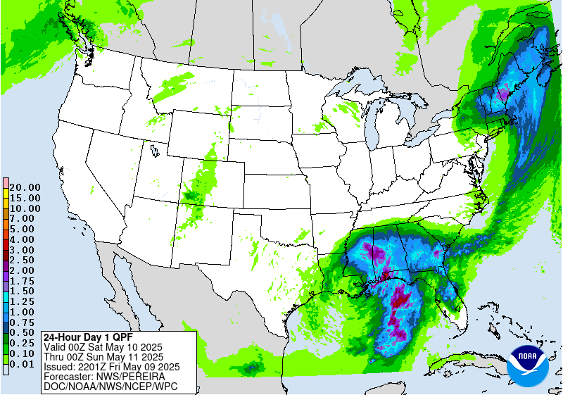
Day 1 — rainfall for Day 1 only (24-hour total)
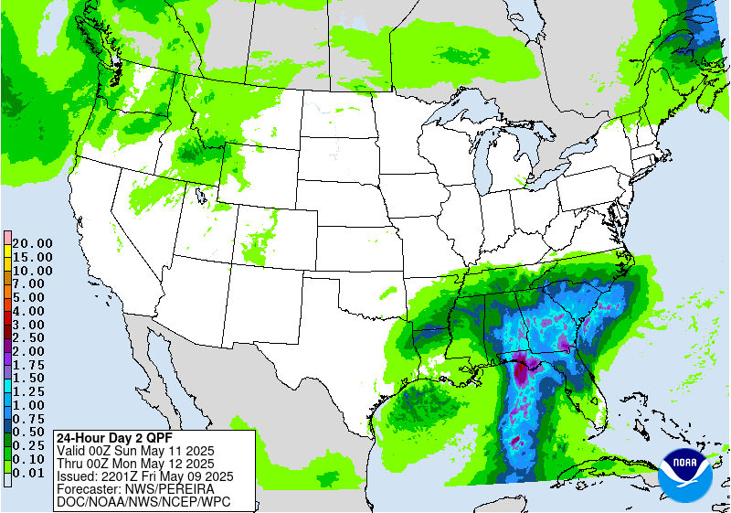
Day 2 — rainfall for Day 2 only (24-hour total)
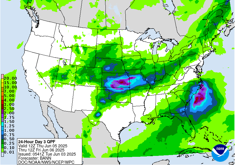
Day 3 — rainfall for Day 3 only (24-hour total)
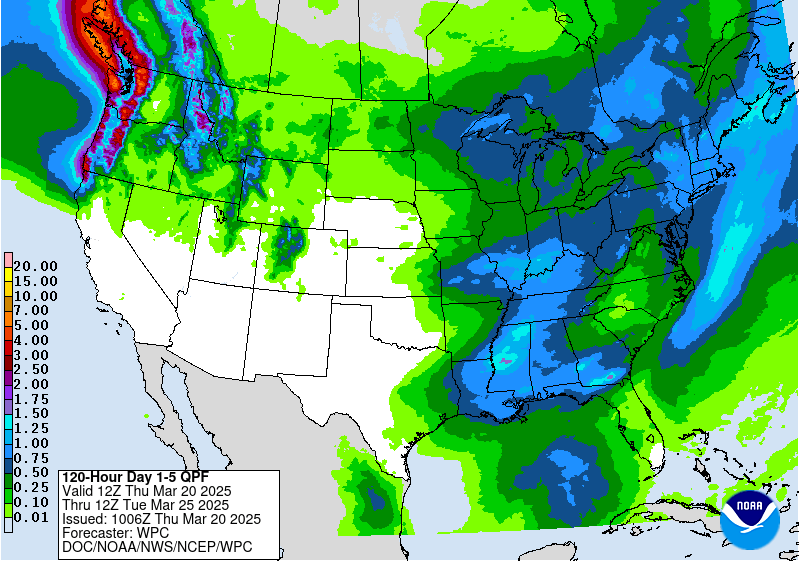
5-day total rainfall (Days 1–5)
SLO County Rainfall
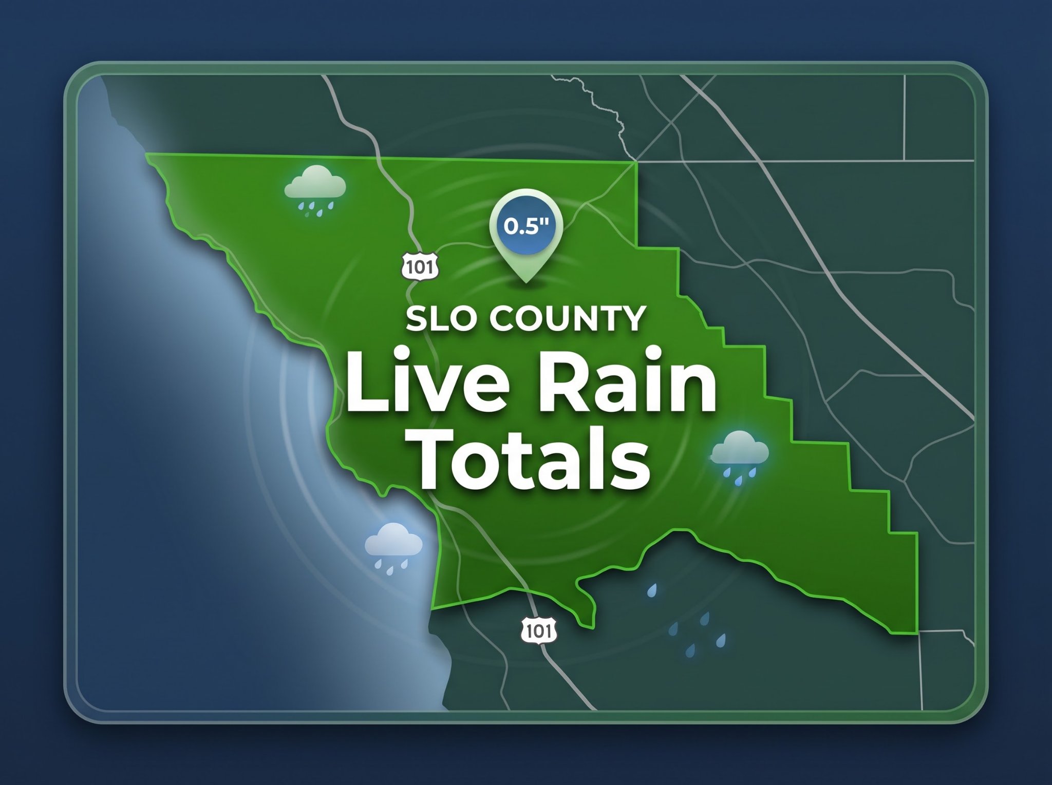
Live totals from Public Works of SLO County — tap a time frame to open the current map.
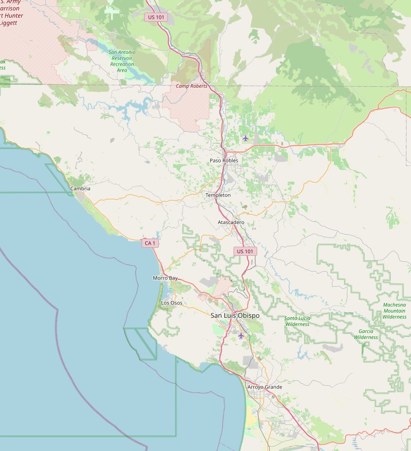
SLO County Reservoirs
Tap a reservoir for its live report — lake level, storage and capacity.
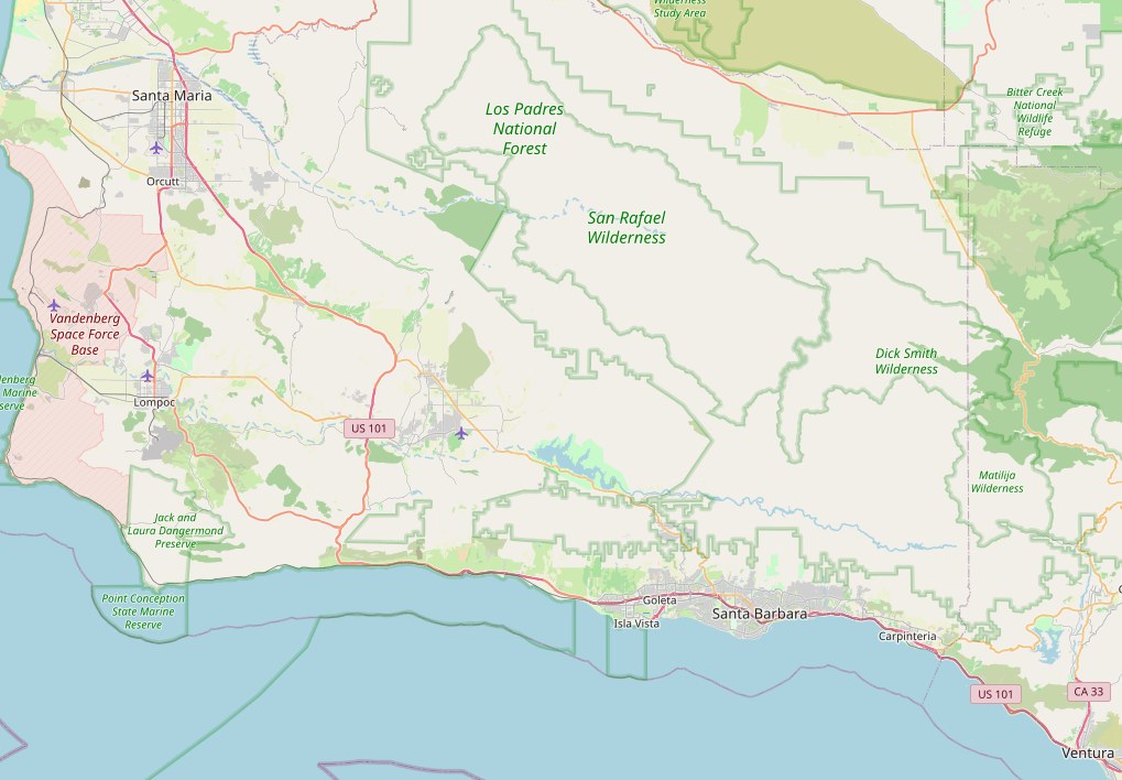
Santa Barbara County Reservoirs
Tap any reservoir to open the county's live reservoir map.
 Twitchell Reservoir
Alisal Reservoir
Lake Cachuma
Gibraltar Reservoir
Jameson Reservoir
Lake Casitas
PDF — updated daily at 8 AM
Ventura County live rainfall map
Reports: SLO County Water Resources, USGS and Santa Barbara County Public Works. Maps © OpenStreetMap contributors.
Frontal animation
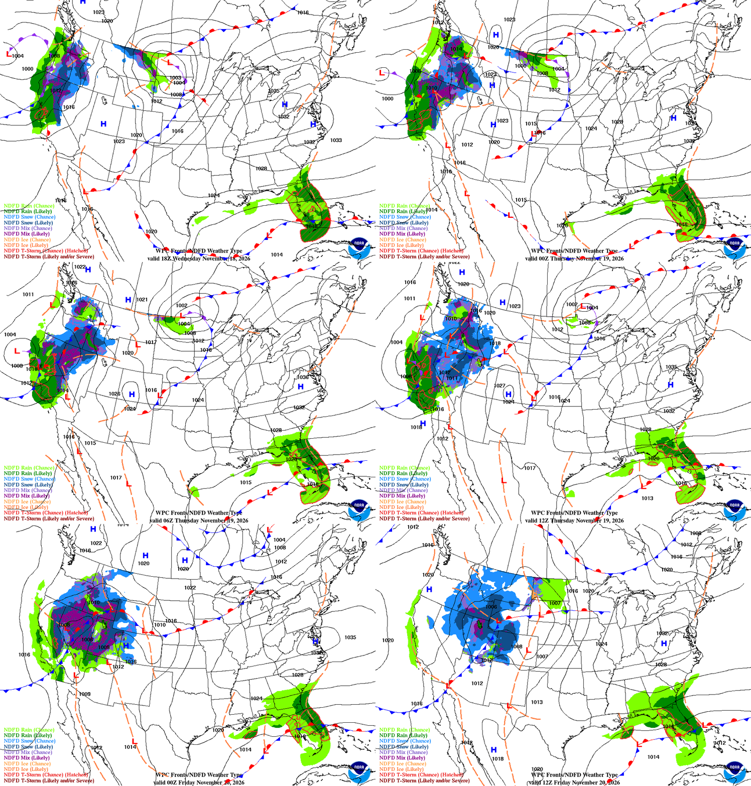
Short-range fronts and weather type, looping Nov 18–20, 2026
Coastal valleys
- Wednesday rain, high near 62: rain likely from late morning, then rain and a slight chance of thunderstorms this afternoon and evening, south wind 10 to 30 mph with gusts to 40. One to 2 inches possible Wednesday.
- Wednesday night rain and a slight chance of thunderstorms, low around 54, southwest wind 15 to 30 mph with gusts to 40, with another 2 to 3 inches possible.
- Thursday rain, high near 61, west wind 15 to 25 mph with gusts to 30, a quarter to a half-inch more; Thursday night a slight chance of rain before 10 p.m., low around 44.
- Friday sunny, high near 62; Saturday mostly sunny, high near 61, with a chance of rain late Saturday night; Sunday a chance of rain, high near 61.
- Monday mostly sunny, high near 62; Tuesday rain likely, high near 63 — the first hint of Thanksgiving-week weather.
Beaches
- Wednesday a 40 percent chance of rain after 10 a.m., high near 63, south wind increasing to 20 to 30 mph with gusts to 40, a tenth to a quarter-inch to start.
- Tonight rain and possibly a thunderstorm, low around 55, southwest wind 25 to 30 mph with gusts to 35, 1 to 2 inches possible.
- Thursday rain, mainly before 4 p.m., high near 62, west-southwest wind 20 to 25 mph with gusts to 30; Thursday night a 30 percent chance of rain before 10 p.m., low around 45.
- Surf: a High Surf Advisory runs through 9 p.m. Friday — breaking waves of 10 to 19 feet with local sets of 20 to 22 feet, peaking late Wednesday through Thursday night, with dangerous rip currents. A Coastal Flood Advisory is in effect Thursday 3 to 10 a.m. for flooding of parking lots, bike paths, and harbor walkways around the morning high tide, plus significant beach erosion. Stay off rocks and jetties and well back from the water.
- Friday sunny, high near 62; Saturday mostly sunny, high near 61; Sunday rain likely, high near 60.
Interior valleys
- Wednesday rain after 10 a.m., high near 57, south wind increasing to 20 to 30 mph with gusts to 40, a quarter to a half-inch possible.
- Tonight rain and possibly a thunderstorm, low around 47, southwest wind 15 to 25 mph with gusts to 35, 1 to 2 inches possible.
- Thursday rain and possibly a thunderstorm, high near 57, west-southwest wind 15 to 20 mph with gusts to 30; Thursday night mostly clear and cold, low around 38.
- Friday sunny, high near 58, with a cold Friday night low near 35; Saturday mostly sunny, high near 58; Sunday a chance of rain, high near 57.
- Monday mostly sunny, high near 57; Tuesday a chance of rain, high near 60.
Santa Barbara Southcoast
- Wednesday rain likely after 4 p.m., high near 66, north wind turning south, less than a tenth of an inch to start.
- Tonight rain likely, then rain and possibly a thunderstorm after 10 p.m., low around 49, south-southwest wind 15 to 20 mph with gusts to 25, 1 to 2 inches possible.
- Thursday rain and possibly a thunderstorm before 10 a.m., then rain likely, high near 65, a quarter to a half-inch more; Thursday night mostly clear, low around 42.
- West-facing Southcoast beaches: the earlier High Surf Advisory has expired, but a fresh swell builds again late Wednesday night through Thursday on top of high tides — use caution at exposed breaks.
- Friday sunny, high near 67; Saturday mostly sunny, high near 65; Sunday a chance of rain late, high near 65; Tuesday a slight chance of rain, high near 67.
Marine — Central Coast
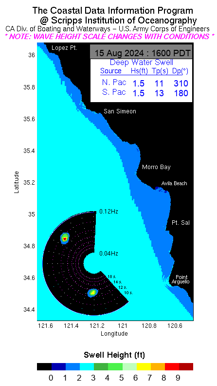
Current swell heights — Point Conception (CDIP)
Dangerous conditions through Friday. A Small Craft Advisory runs through this afternoon, then a Gale Warning takes over from 3 p.m. today to 3 a.m. Thursday for the waters north of Point Sal, with gales also likely in the outer waters. Today: southeast wind 10 to 20 knots becoming south 20 to 30 knots with gusts to 40, a chance of rain after 10 a.m., mixed swell west-northwest 5 to 6 feet and south 4 feet, wind waves building to 5 feet. Tonight: southwest wind 25 to 30 knots, rain and possibly a thunderstorm, swell building to west-northwest 7 feet and south 7 to 9 feet, wind waves 4 to 6 feet. Thursday: west-southwest wind 20 to 25 knots with rain mainly before 4 p.m. and a west swell of 12 feet; Thursday night the west-northwest swell runs 10 to 12 feet. Large breaking waves may impact Morro Bay Harbor, and Pismo and Cayucos may see breaking waves at or over the base of the piers. Thunderstorms through Thursday afternoon can bring gusty winds, heavy downpours, and lightning. Conditions improve Friday, with the west-northwest swell easing to 7 to 9 feet, and Saturday turns mild.
🌊 Tides — Port San Luis: high tide 4:40 PM (3.75 ft), low tide 11:07 PM (1.05 ft).
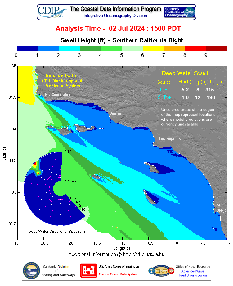
Current swell heights — Southern California Bight (CDIP)
Marine — Southcoast
Small Craft Advisory conditions continue in the Santa Barbara Channel through Friday, with gale-force gusts possible at times, mainly in the evening hours. Winds and seas ramp up today as the front approaches: rain is likely after 4 p.m., then tonight south-southwest wind 15 to 20 knots brings rain likely, turning to rain and possibly a thunderstorm after 10 p.m. Thursday: west-southwest wind around 15 knots with gusts to 20, rain and possibly a thunderstorm before 10 a.m., then rain likely. The swell eases this morning, then another peak arrives late Wednesday night through Thursday, and dangerous breaking waves are a threat at the Ventura harbor entrance, though lesser than at Morro Bay. Conditions improve Friday and turn mild Saturday; another system is possible Sunday.
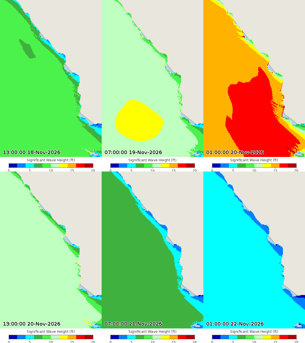
Wave height forecast — click for forecast
🌊 Tides — Santa Barbara: high tide 4:26 PM (3.76 ft), low tide 10:52 PM (0.99 ft).
El Niño Status
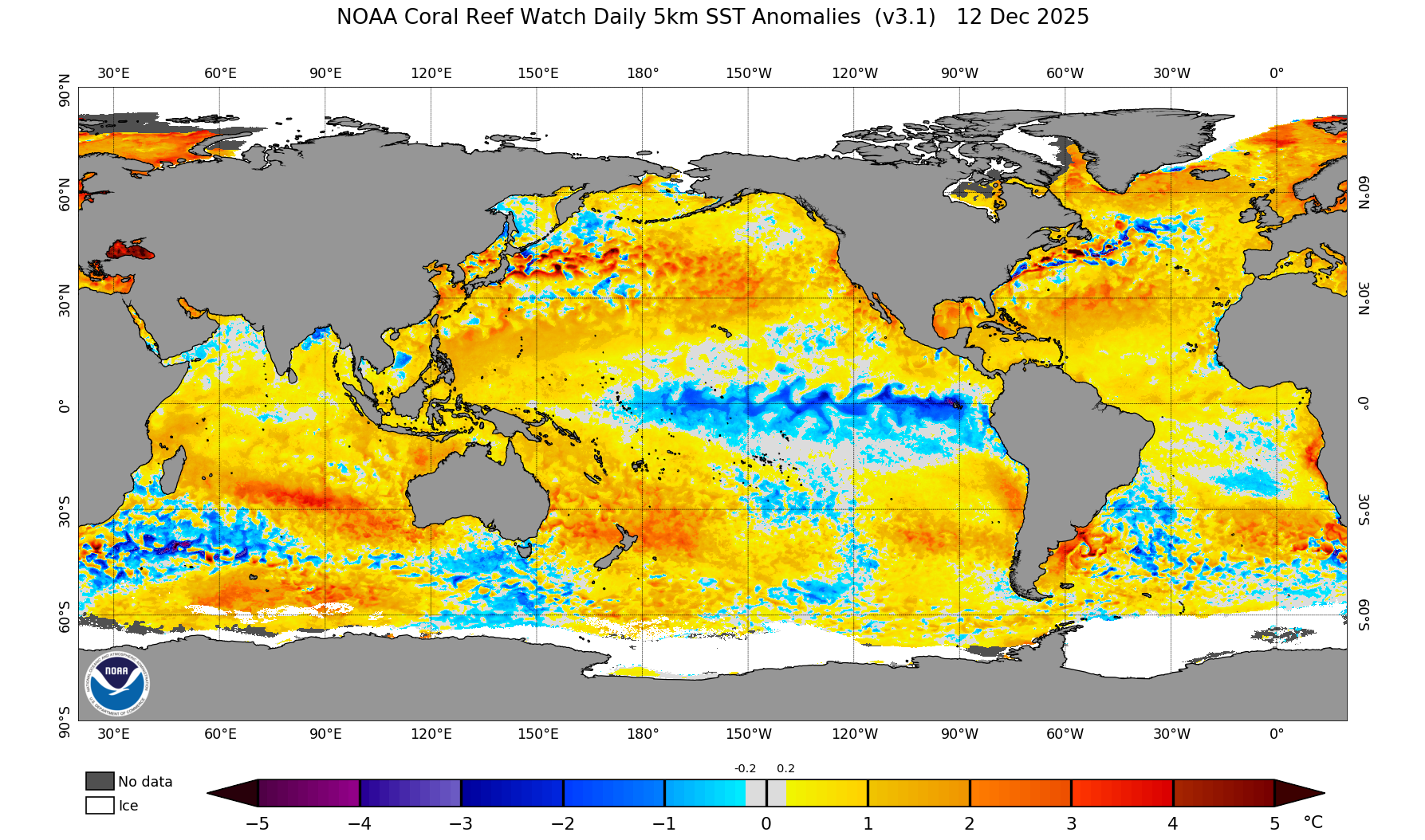
Sea surface temperature anomalies — latest
El Niño is strengthening, and it is now a big one. Sea surface temperatures in the eastern equatorial Pacific are running more than 4 degrees Celsius above average, with the key Niño-3.4 region at +2.5°C, Niño-3 at +3.6°C, and the far eastern Pacific at a remarkable +4.4°C. The warm water runs deep, too — subsurface temperatures are more than 10 degrees above average at depth — a deep reservoir that will keep feeding this event.
The Climate Prediction Center says a strong-to-very strong El Niño is likely through January–March 2027, at better than a 79 percent chance, and there is now about a 60 percent chance this becomes a historic El Niño, exceeding any since 1950. It is expected to keep strengthening before it begins to weaken in early 2027.
What it means for us: a strong El Niño tilts the odds toward a wetter-than-average winter across California, with more storms tracking into the state. It is not a guarantee — even a very strong El Niño does not promise rain in any given week — but the chances of a wet winter are higher than normal. The next official update comes December 10.
One view of just how big this El Niño could get — Rebekah Jones is sounding the alarm that it could shatter records going back to 1877:
Long-range outlooks
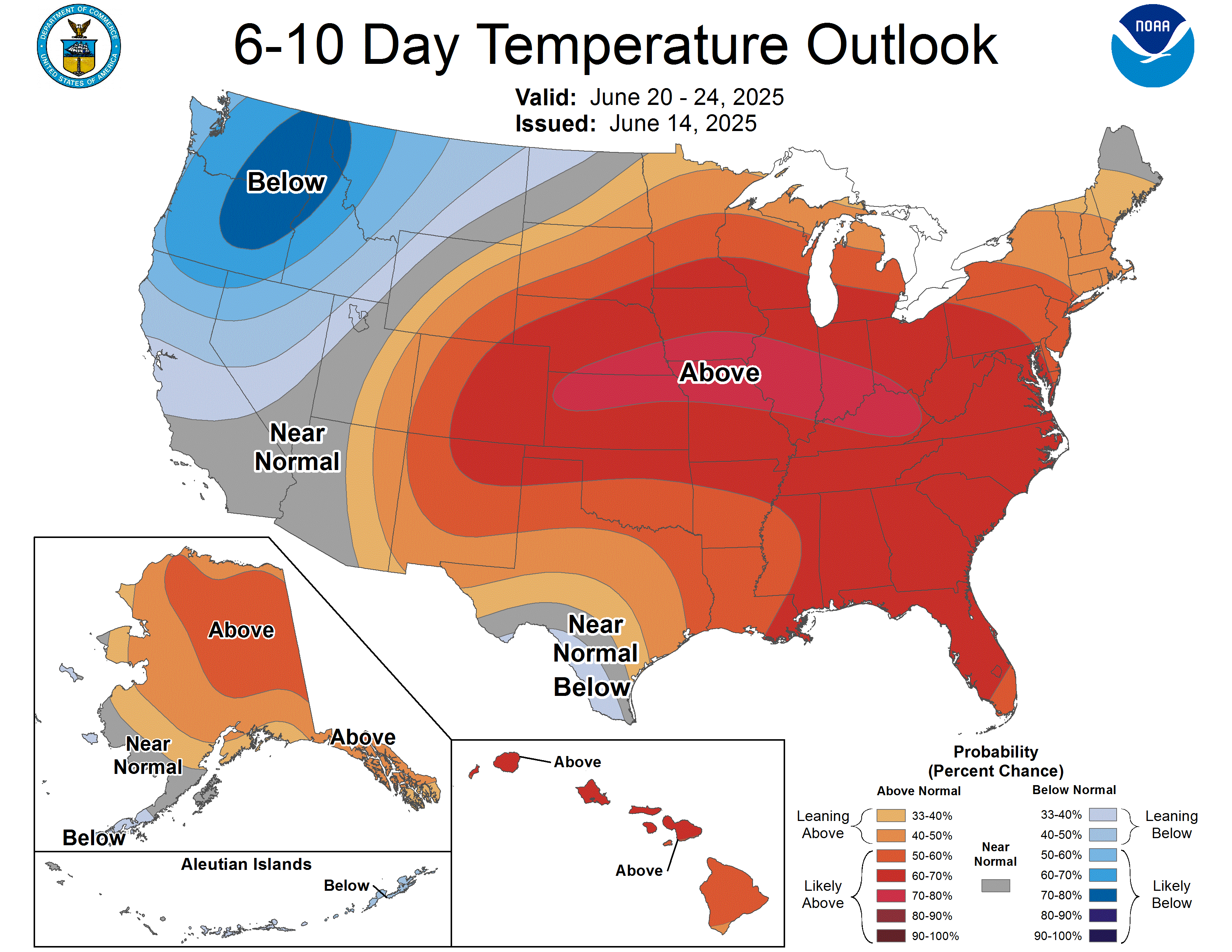
6–10 Day Temperature Outlook
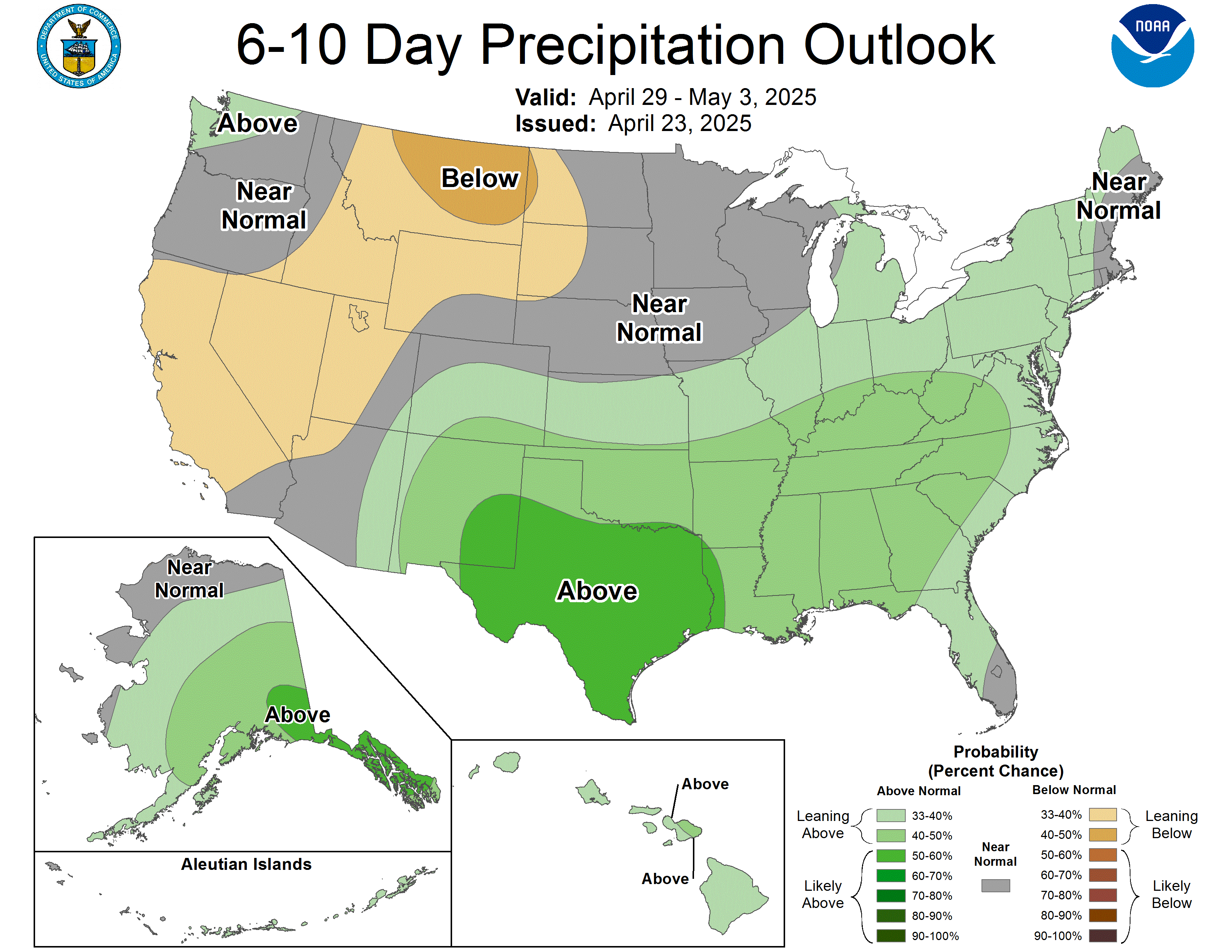
6–10 Day Precipitation Outlook
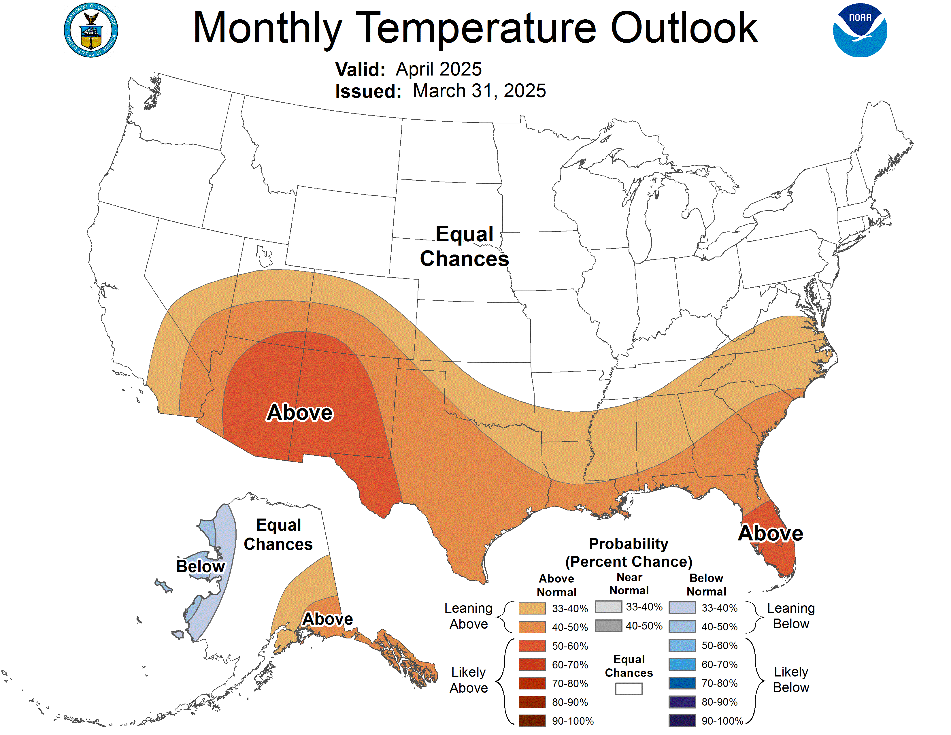
30-Day Temperature Outlook
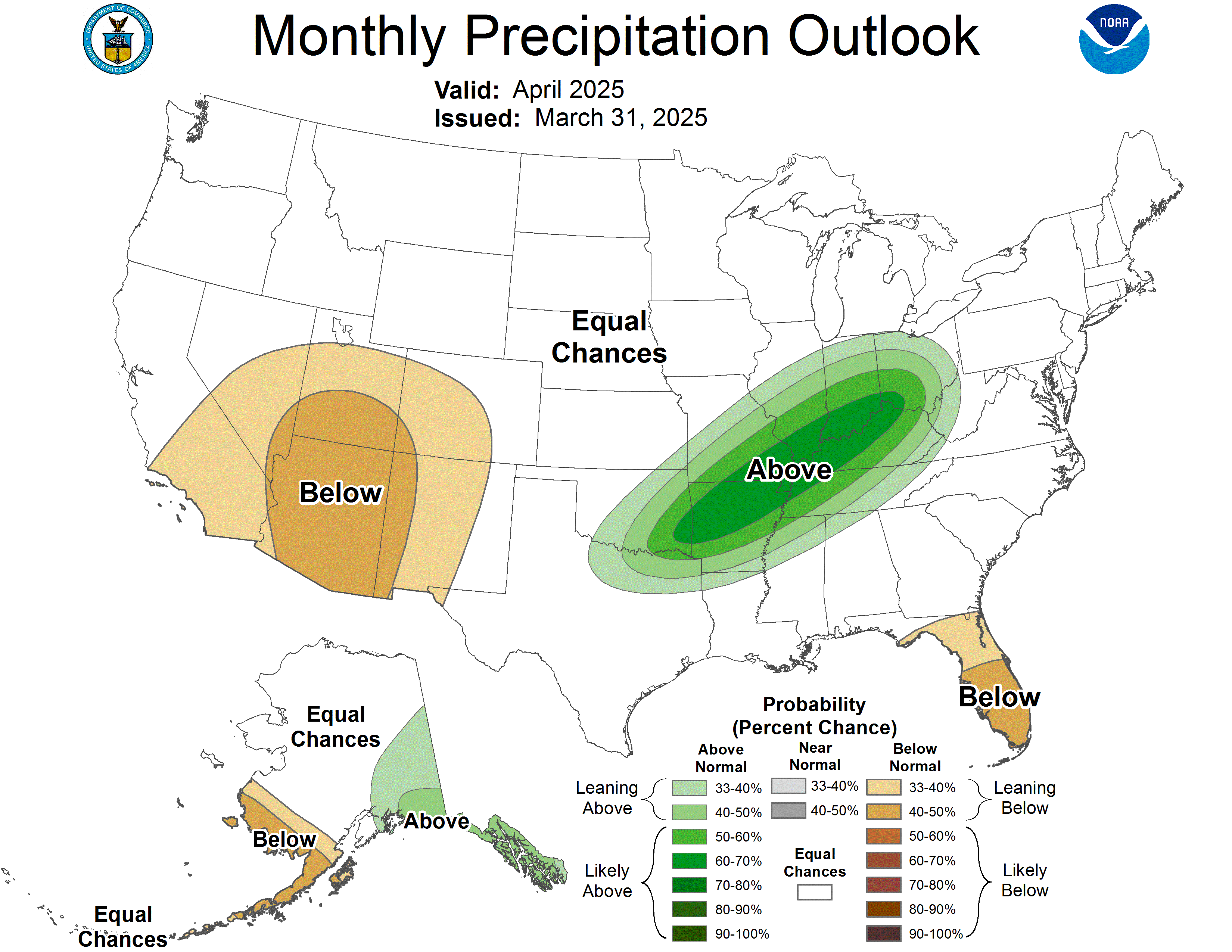
30-Day Precipitation
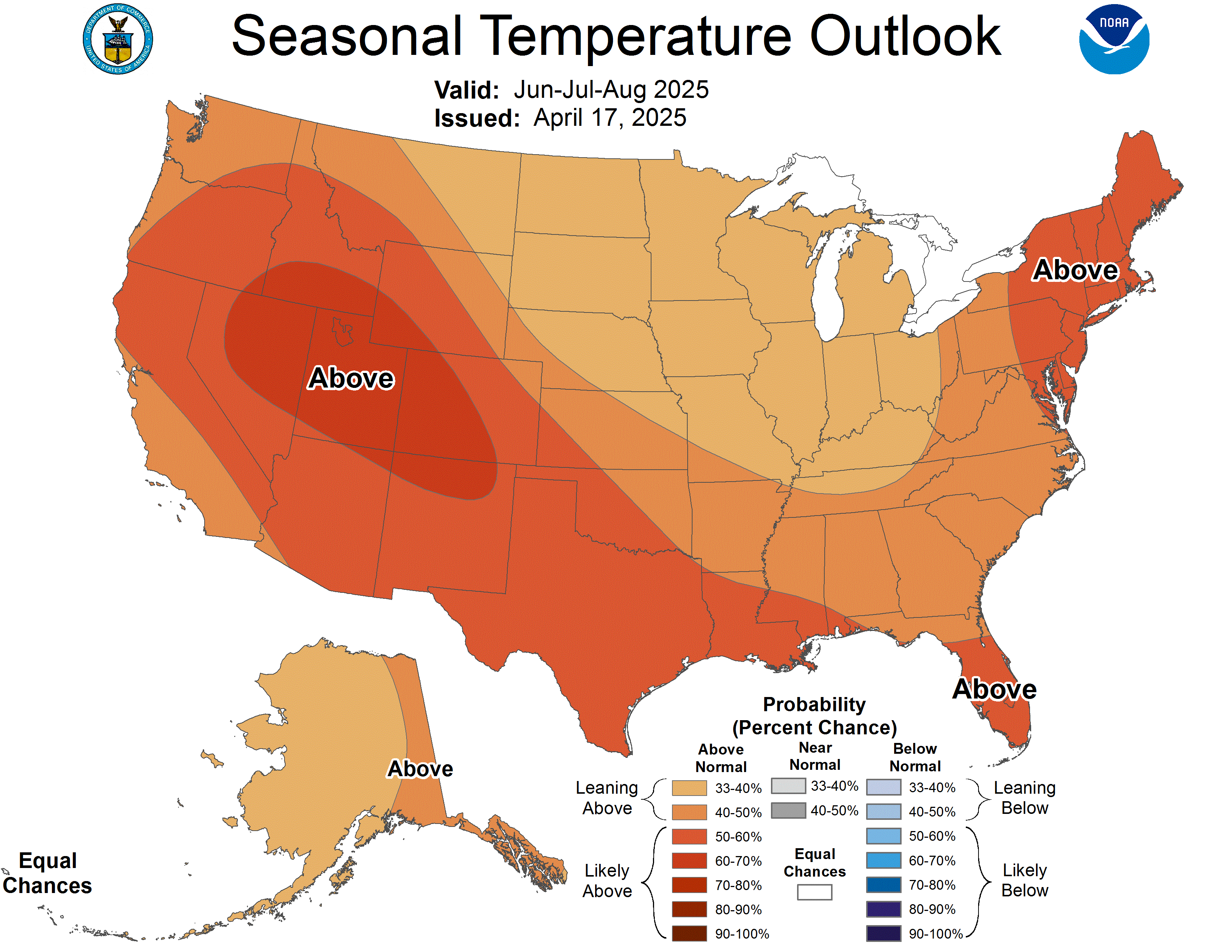
60-Day Temperature Outlook — Lead 2
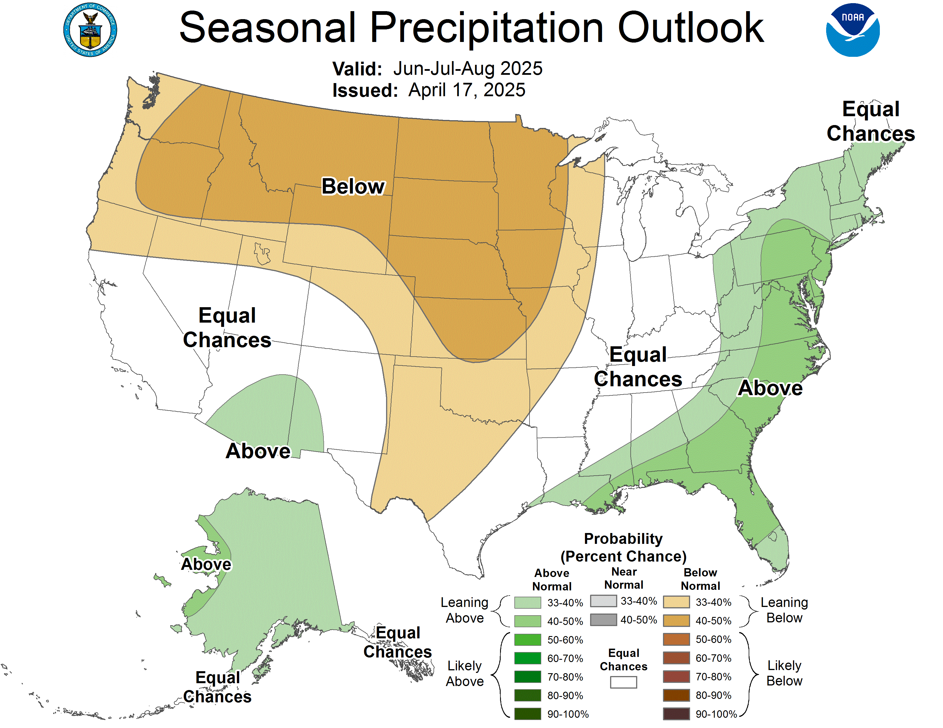
60-Day Precipitation — Lead 2
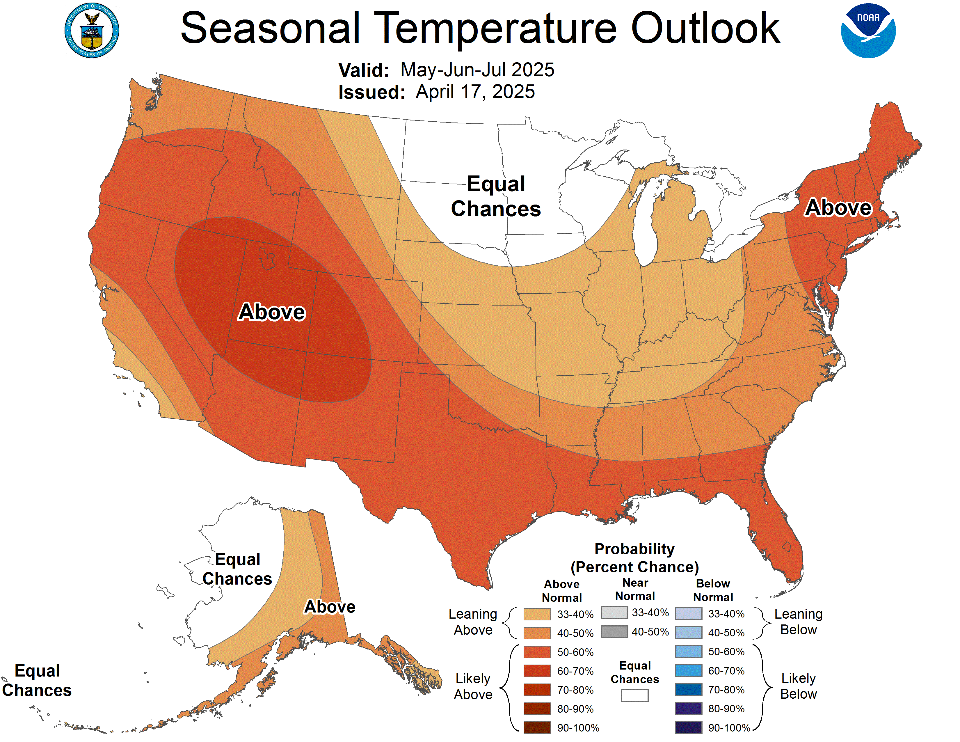
90-Day Temperature Outlook — Lead 1
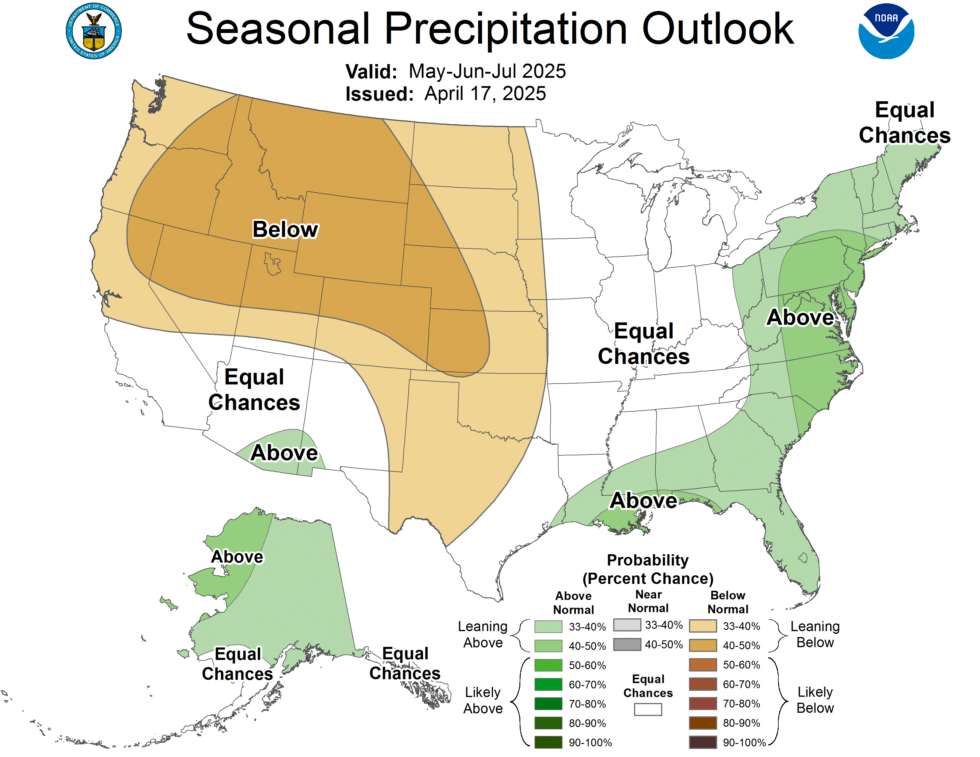
90-Day Precipitation — Lead 1
X — @tvdave · Facebook — TVDaveHovde · Instagram — @tvdavehovde · TikTok — @tvdavehovde · LinkedIn — David Hovde · Email — 805weatherman@gmail.com